The picturesque moon: reading the Carte générale de la lune
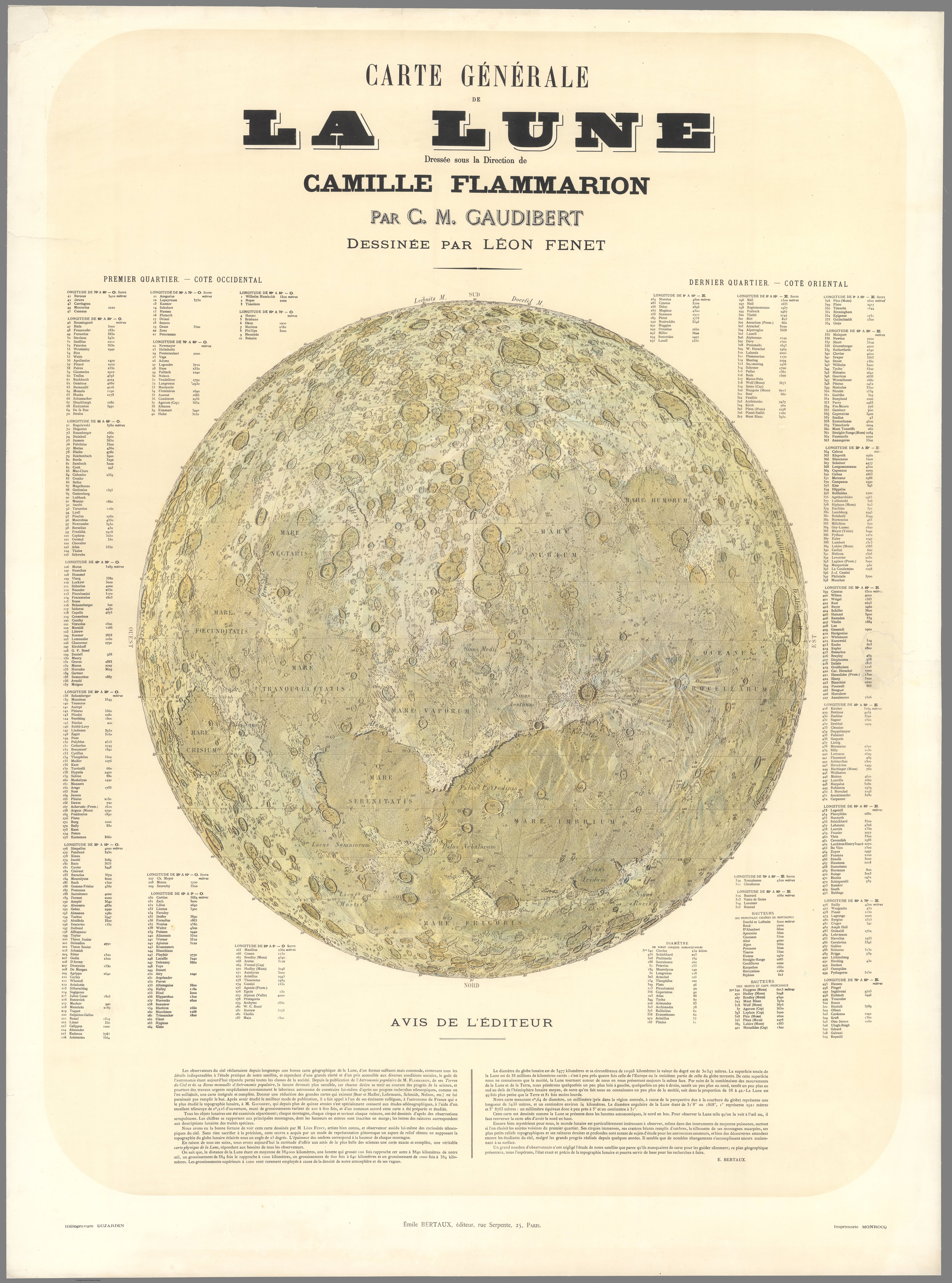
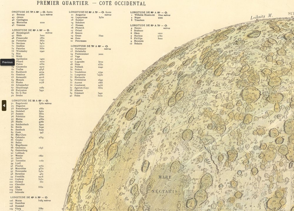
The Carte générale de la lune, published in Paris in 1887 by Émile Bertaux, is a hand-drawn lithographic wall map of the moon’s near side. It is the product of a four-way collaboration: the astronomer Casimir Marie Gaudibert, who spent more than 15 years observing the moon through a telescope; the popular astronomer Camille Flammarion, who directed the project and lent his name and institutional weight; the publisher Émile Bertaux; and the artist Léon Fenet, who rendered the final image. The map represents the moon as it appears through an astronomical telescope, with north at the bottom, and surrounds the lunar disc with lists cataloguing 509 craters, mountain ranges, and other features, organized by the lunar phase under which each was best observed.
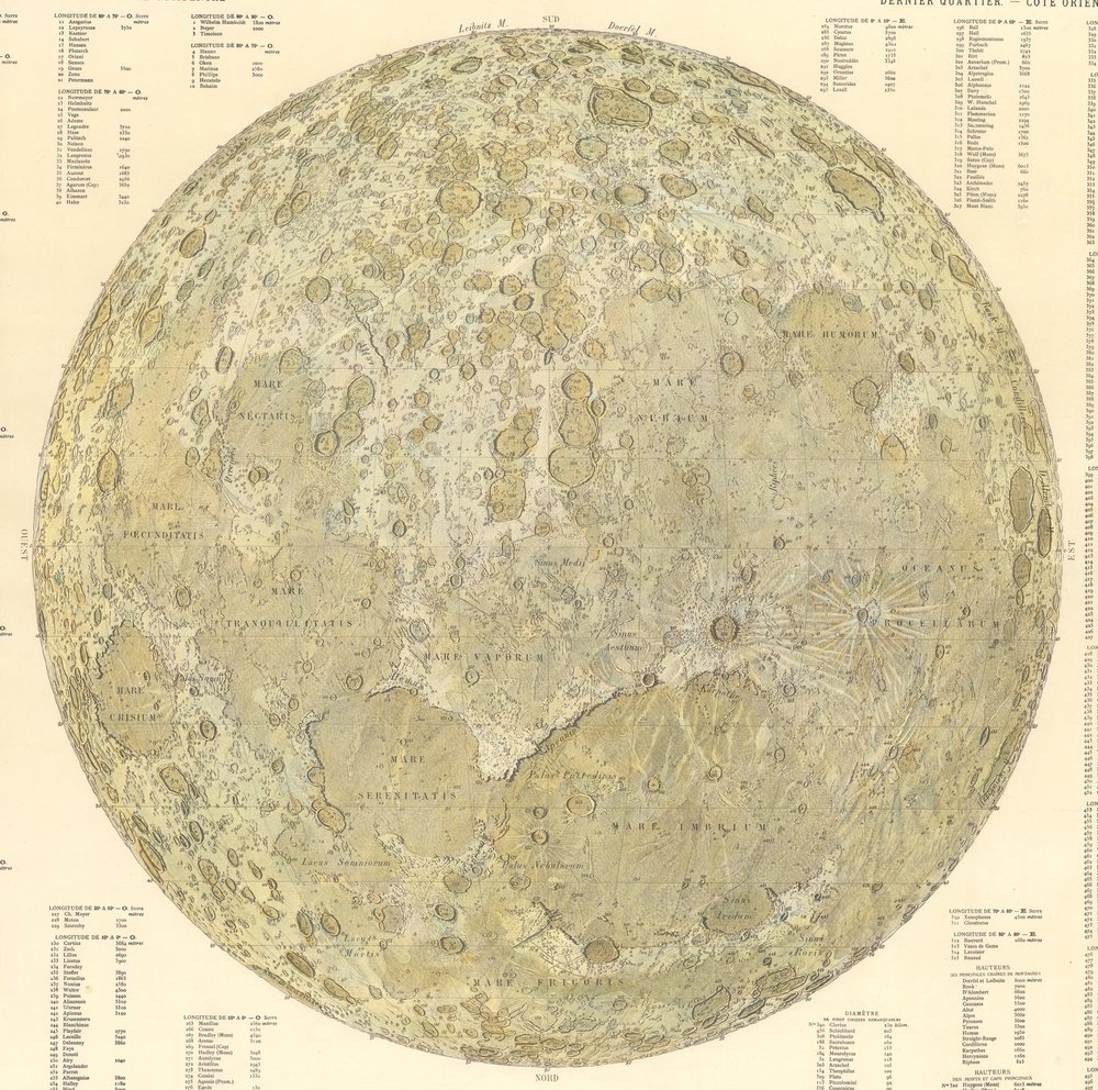
The map is striking because it tries to do two things at once. The first is to function as a scientific instrument, a carte physique de la Lune, as Bertaux’s preface calls it, intended to “serve as a base for research to be done” by amateur and professional astronomers alike. The second is to be visually compelling, even artful. Fenet renders the moon at an oblique illumination angle of 25 degrees, with shadow depths corresponding to mountain heights, producing a dramatic sculptural relief that the publisher openly describes as “picturesque.” This was, in a sense, a marketing decision as much as a scientific one. Flammarion was a popularizer, and the map was meant to reach a wider public than the specialist atlases that came before it. The term picturesque, though, invokes an aesthetic tradition, one borrowed from landscape painting, which sat uneasily with the era’s growing reliance on photography as the standard of scientific representation.
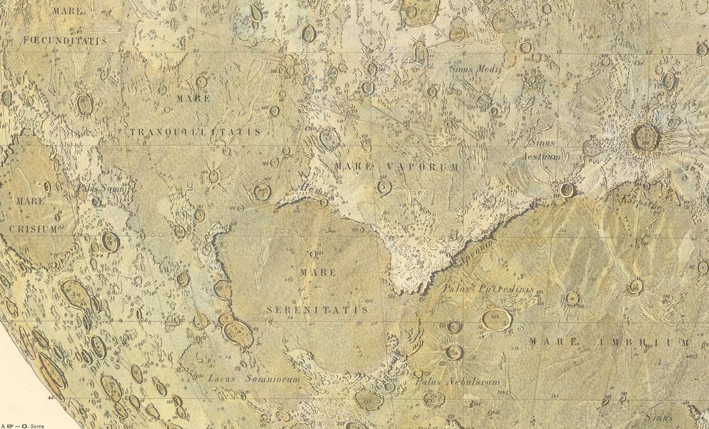
What’s strange about the map, viewed up close, is how much it resembles a fantasy map. The mountain ranges and maria are not far from what Christopher Tolkien would later use to render Middle Earth, or what Ursula Le Guin created to map out Earthsea. This is not really a critique of Fenet, who was working within the inherited visual vocabulary of 19th century cartographic illustration. But it raises a real question about what makes this map scientific rather than imaginative. The answer is not the image itself, which a viewer could mistake for a fictional terrain. The answer is everything surrounding the image: Gaudibert’s 15 years of observations, the lists with their measured altitudes in meters, Flammarion’s institutional name, the Société astronomique de France. The subtext does the work of anchoring the image to the real. Strip the lists and the publisher’s note away, and you would have something that could illustrate a Jules Verne novel. Flammarion himself, along with being an astrologist and spiritualist, was a science fiction writer.
This is also where the map’s blending of scientific and aesthetic registers becomes most interesting, and most questionable. By 1887, lunar photography was real and improving: De la Rue and Rutherfurd had produced credible photographic plates two decades earlier. A photograph would have offered a different epistemic claim, one rooted in mechanical objectivity rather than an artist working from an astronomer’s notes. Gaudibert and Flammarion chose drawing instead, presumably because it allowed them to compose the best observed version of every feature into a single coherent image (something a photograph, capturing only one moment of illumination, could not do). But this means the map’s scientific authority depends entirely on trust in Fenet and the observational program behind him. The picturesque rendering is not decoration laid on top of objective data; it is the data filtered through a hand rather than a machine. Whether that blend serves any real purpose depends on how one feels about that filtration. For Flammarion’s intended audience, observers who would use the map to recognize features through their own telescopes, it probably worked decently well (though the labels on the map itself are fairly hard to read). For us, looking back, it seems more like an amazing piece of art rather than a scientific map, and as such it is largely forgotten because the photographic mode dominated soon after.